ASEAN, Australia Strengthen Partnership to Support Disaster Management and Emergency Response

asean-australia

asean-australia

JAKARTA, 19 May 2015 – ASEAN Deputy Secretary-General for Socio-Cultural Community, H.E. Alicia Dela Rosa Bala and Australia’s first resident Ambassador to ASEAN, H.E. Simon Merrifield, today signed Amendment No. 6 to the Cooperation Arrangement between ASEAN and the Commonwealth of Australia represented by the Australian Department of Foreign Affairs and Trade on the ASEAN Agreement for Disaster Management and Emergency Response (AADMER) Work Programme 2010-2015 at the ASEAN Secretariat.

DSG Bala expressed appreciation to Australia for its steadfast assistance to ASEAN Community building efforts, especially in the area of disaster management, which is one of the areas of priority collaboration under the Plan of Action (POA) to implement the Joint Declaration on ASEAN-Australia Comprehensive Partnership (2015-2019). “Australia has provided much needed support for the implementation of priority projects under the strategic components and building blocks of the AADMER Work Programme, such as capacity building for our ASEAN Emergency Response and Assessment Team, establishment of the ASEAN Disaster Management Training Institutes Network and most importantly, the operationalisation of the ASEAN Co-ordinating Centre for Humanitarian Assistance on disaster management (AHA Centre),” she said. “Through the Cooperation Arrangement, Australia has also supported ASEAN’s strategic initiatives, including a lessons learned exercise of ASEAN’s post-Haiyan’s response, and  providing the capacity needed for ASEAN’s efforts in building cross-sectoral and multi-stakeholder collaboration,” DSG Bala added.

Meanwhile, Ambassador Merrifield reiterated Australia’s commitment to strengthen its cooperation with ASEAN on disaster management. “Australia has supported the implementation of the AADMER and the establishment of the AHA Centre from the beginning, and the signing today, extending our support until the end of 2016, demonstrates our commitment to using regional solutions to prepare and respond to disasters, and our recognition of ASEAN’s importance in this regional role,” said Ambassador Merrifield.

“I congratulate the ASEAN Secretariat and the AHA Centre for their strong and effective leadership, and for the significant support they have made to assist ASEAN Member States to improve their own response capabilities across the region,” Ambassador Merrifield added. 

Australia, which became ASEAN’s first dialogue partner in 1974, was also one of the earliest partners to pledge its support for the implementation of the AADMER Work Programme at the AADMER Partnership Conference held in May 2010 in Makati City, the Philippines.  This commitment was subsequently formalised through the signing of the Cooperation Arrangement on 9 August 2010. Since then, the Cooperation Arrangement has been amended to extend the assistance up to 31 December 2016, and reflects a total contribution of AUD 4,565,000.

Planning, Coordination Have Come a Long Way Since Eruption of Mount St. Helens

When Mount St. Helens erupted 35 years ago, officials were ill-prepared for the magnitude of the emergency.

Kate Prengaman, Yakima Herald-Republic | May 18, 2015

Mount St. Helens on May 18, 1980

(TNS) — When Mount St. Helens erupted 35 years ago Monday, killing 57 people and blanketing much of Central Washington in ash, officials were ill-prepared for the magnitude of the emergency.

“When the mountain blew, everyone was kind of out there on their own,” said Charles Erwin, emergency management specialist for the city of Yakima. “That’s what got the county started on doing disaster planning and coordinating with all the local jurisdictions.”

The explosion caused two different disasters on either side of the mountains. While the west side was dealing with mud and debris flows taking out bridges and roads, the prevailing winds pushed an estimated 520 million tons of ash eastward, turning Sunday morning in Yakima into midnight.

Local, state and federal officials say the eruption and the disorganized response prompted the development of planning and response protocols that officials say have made the region more prepared for a future eruption — because it’s only a matter of time before the volcano erupts again.

“We know we have recharge of magma chamber right now,” said Carolyn Driedger, scientist with the Cascade Volcanoes Observatory. “We’re fairly confident that the monitoring equipment we have there now will give us about as good a warning as we can get that there is magma rising. We could have an eruption with a few days of warning; it could be 100 years from now.”

And Mount St. Helens isn’t the only volcano Washington has to worry about. Mount Adams, Mount Rainier, Mount Baker and Glacier Peak are also capable of producing destructive mud and debris flows, known as lahars, and spewing ash.

Although Mount St. Helens has the most recent and most destructive activity, all five have generated ash or lahars in the past 300 years, according to the state’s hazard mitigation plan.

But in Yakima County, the primary danger is ash, according to the county’s emergency management plan.

Countless tons of it fell across much of the county during the 1980 eruption. It clogged waterways and cut visibility on roads to levels so dangerous that highways were closed for days. Merely walking in it kicked up clouds of ash.

Inhaling ash can cause lung damage, especially for those with existing respiratory conditions. Volcanic ash is acidic and when it combines with water it can create a form of sulfuric acid that can, in some cases, be strong enough to burn skin, damage crops and corrode machinery.

Preparing to deal with ash is the most important thing communities in Yakima County can do, Erwin said.

“What we’re trying to do again, since it’s far from people’s memory now, is to encourage all the cities to have plans for clearing ash from the streets and where to dump it and how to answer citizens’ questions about what to do with it,” Erwin said.

He recommended that all area residents add dust masks and goggles to their emergency kits to be prepared for an ash event.

Across the state, communities at risk from volcanoes work together on coordinated response plans, said Mark Stewart, spokesman for the Washington Military Department’s Emergency Management Division.

Each plan is different because each volcano is different, he said.

“Our five volcanoes have what I would call a different eruptive personality,” Stewart said. “We all know Mount St. Helens is a big exploder. Mount Rainier, on the other hand, is a lahar producer, and hundreds of thousands of people live in harm’s way of those lahars.”

One coordination plan addresses both St. Helens and Mount Adams, because the at-risk areas overlap. It’s developed by the Forest Service, state and federal geologists, and the emergency management officials from the surrounding tribes and counties, including Yakima and Klickitat.

The plan divides up responsibilities and channels of communication. For example, the Forest Service will make road closures as needed to protect public safety, and the state Emergency Management Division will coordinate the use of aircraft for emergency responses.

This multi-agency response plan simply didn’t exist 35 years ago, said Doug Ficco. When St. Helens blew, Ficco was a maintenance engineer with the state Department of Transportation from Southeast Washington to Southwest Washington, where he was trying to figure out how to save bridges from the vast amounts of water and debris gushing down from the mountain. Now as a DOT regional administrator in Vancouver, he said much has changed in terms of disaster preparedness.

“Back then, we didn’t do a lot of pre-planning for emergencies. We didn’t have relationships in place with the Corps of Engineers and the National Guard,” Ficco said. “It was a little chaotic.”

Now, he said, multi-agency emergency drills are part of the routine.

Putting the response plans into action starts with observational data of the volcanic activity from the Cascades Volcano Observatory, which is run by the U.S. Geological Survey.

Driedger said the 1980 eruption also triggered increased investment in monitoring equipment for the mountain and more research to understand what’s normal volcano behavior and what’s a warning sign that an eruption could be imminent.

“That eruption really changed the way we as scientists do business; we realized we need to work with emergency managers,” Driedger said. “We can draw a direct line from the St. Helens eruption to those coordination plans and awareness that we know today.”

Advances in volcano monitoring and communication technology mean that the region is more prepared today to get people out of harm’s way in time before an eruption, Stewart said.

“I have a high level of comfort that if it should happen again, procedures are in place to get critical infrastructure up and running and keep people safe,” Erwin said of Yakima County’s response plan.

But even with preparations to protect water supplies and power substations, and plans to get the roads cleared quickly, ash is still likely to cause problems.

In 1980, farmers were worried about the potential impacts to crops and there was little information about how best to respond. “It was such an unknown. Very few people have gone through being covered up by volcanic ash,” recalls Alan Taylor, who was then sales promotion manager for Northwest Cherry Growers in Yakima. “Going through that was all uncharted territory in agriculture.”

He said farmers tried a variety of techniques to remove the ash from crops quickly and to quell rumors that the ash could poison the cherry crop. But he said the biggest lesson farmers learned probably wasn’t how to be prepared, but realizing that sometimes Mother Nature just has the upper hand.

There are so many variables to a potential eruption — from what time of year to how much ash — that the ideal response from the industry will just depend on the conditions, agreed James Michael, vice president of Marketing for the Washington Stone Fruit Commission.

“In the case of the mountain blowing up, it’s not an exact science,” Michael said. “The technology in our industry is changing so rapidly that it’s hard to predict, but some of those investments in cleaning and washing technology could help salvage fruit after an incident.”

Driedger said the way Eastern Washington handled the ash challenge in 1980 provided a lot of important insight for scientists about the best way to protect water supplies and coordinate cleanup efforts.

“It was really the first modern eruption in U.S. history, and the people in Eastern Washington made a worldwide contribution by documenting their experiences in 1980,” she said. “One really important thing as we move on in time from that memorable eruption is that memory really needs to be transmitted down through time so future generations don’t forget that these are active volcanoes, and you need to be prepared for them to act up from time to time.”

©2015 Yakima Herald-Republic (Yakima, Wash.). Distributed by Tribune Content Agency, LLC.

source: emergencymgmt.com

Govt urged to improve management of tsunami shelters

The Tsunami Alert Community (Kogami), an NGO educating people on disaster risk reduction in West Sumatra, is urging the provincial administration to improve the management of escape buildings or temporary evacuation places (TES) to increase their effectiveness.

Kogami executive director Tommy Susanto said that although the provincial and Padang city disaster mitigation agencies (BPBD) had announced a number of buildings as TES, their effectiveness was still in question.

“The buildings will not function optimally unless they come with signboards identifying them as TES, the owners agree to open the buildings when there is an earthquake that has the potential to cause a tsunami and people are regularly trained to evacuate to the buildings,” Tommy told The Jakarta Post, on Sunday.

He also questioned why a number of buildings located within 500 meters from the shoreline had been publicized as being TES despite the fact that they were at risk of being destroyed when a tsunami hit.

The only real new TES, according to Tommy, were two that were located in Koto Tangah. Both, which were opened only three weeks ago, were built by the National Disaster Mitigation Agency (BNPB) and each had the capacity to hold between 4,500 and 5,000 evacuees.

“Both are in need of better daily building management and people in the surroundings also need to be trained to make use of them,” he said.

Lack of management had led to traffic congestion and panic everywhere during the 2012 earthquake as hundreds of thousands of people drove to the east, away from the beach.

They did not make use of the buildings previously known as shelters, such as school buildings, because the school keepers would not open the gates for evacuees.

“Such things would not happen if the regional administrations had the guts to officially declare the buildings as TES and put signboards there,” Tommy said.

He said such a situation could occur again if the management of the TES buildings was unclear and people lacked knowledge.

Kogami recorded that between 300,000 and 400,000 of Padang City’s 1 million population were possibly threatened by a tsunami. Most of them lived in the Koto Tangah district, which is a sloping area and lacks escape routes for getting away from the beach.

Tommy admitted that efforts had been undertaken by the government after experts considered Padang to be a tsunami-prone city. Similar efforts had also been done by the private sector, including the Ibis and Grand Zuri hotels, which had declared their buildings to be public tsunami shelters.

Tommy, however, asked the BPBD to be selective in naming a building as a TES, to apply better TES management and to regularly train locals on the use of a TES. He also suggested that buildings located within 500 meters of a beach should not be named TES.

The head of the provincial BPBD’s prevention and preparedness division, Rumainur, said that there are currently 26 buildings with a combined capacity for 70,000 evacuees that could function as TES in Padang. The number does not include two more that are to be built this year in Koto Tangah.

Rumainur said that some 500,000 people in Padang live in tsunami red zones. Of them, 200,000 would not be able to escape away from the beach. The existing TES, he said, would be able to accommodate some one-third of the people.

“We only need to build TES to accommodate the remaining 130,000 people,” Rumainur said.

Of the existing TES buildings, according to Rumainur, most were government office buildings that had been rebuilt stronger after the 2009 earthquake, school buildings, campuses, mosques, new hotels and old buildings that had survived previous tsunami.

source : http://www.thejakartapost.com

Quake jolts govt to formulate disaster management plan

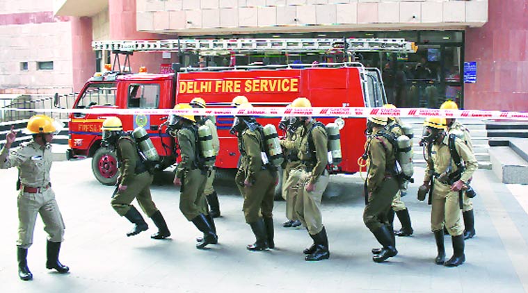
Even as tremors from aftershocks in Nepal after Saturday’s earthquake continue to rumble across the city, the Delhi government is yet to finalise the mandatory state disaster management plan.

While the capital’s respective districts have their local plans drawn up and ready, it still awaits the green light from the Delhi Disaster Management Authority (DDMA) that includes the Lieutenant Governor and Chief Minister.
Delhi, with its population of 16 million, falls under seismic zone IV.

According to the Vulnerability Atlas of India (1997), for shaking intensity VIII, 6.5 per cent houses in Delhi face high damage risk and 85.5 per cent houses face moderate damage risk.

Also, most buildings in Delhi may not meet requirements on seismic resistance.

In order to mitigate the consequences of a disaster, DDMA officials said engineering intervention is needed in buildings and structures to make them strong enough to withstand the impact of natural hazard.

Dormant for more than a year now — save a meeting or two — the DDMA is now ready with the draft of the state disaster preparedness and mitigation plan.

Incidentally, the draft was formulated in March 2014 and presentations were made before officials of the National Disaster Management Authority (NDMA) in a meeting last October.

“Since then, there have been minor changes in the draft which is an ongoing process. A few recommendations were made and we had to include these. We have done that now and the draft is ready,” a senior DDMA official said.

However, the draft is yet to be approved by the state executive committee headed by the Delhi chief secretary.

It lists out building critical infrastructure such as roads, drinking water, communication network, health and sanitation, physical and social environment.

The draft reads, “In view of these components, a risk assessment study was conducted. It identified that Delhi is densely built and consists of a large urban population. Any major earthquake or fire/chemical explosion can affect districts very badly. Although various steps have been taken by the government, a high degree of awareness and training is still required.”

The draft also states that urban disaster management and disaster mitigation strategies minimise risk and should be incorporated in masterplan of Delhi.

Incidentally, Delhi still lacks a disaster response fund — something the Disaster Management Act, 2005, mandates.

Ashwani Kumar, Commissioner (Revenue) said, “A state disaster response fund was supposed to be created. It has been delayed due to the long process involved. The file has gone to Central government for approval. As far as the mitigation funds are concerned, we have discussed and decided that it is best if the departments create a planned fund for the head

of disaster management rather than coming to the divisional commissioner for approvals. The file will now be processed.”

Audit outlines shortfalls in 2012 mock drill

Pinkerton, an agency, was given the task to collate findings of the mega mock drill that was conducted on February 15, 2012 to ascertain the preparedness of the city for any disaster. The Indian Army also did an audit of mock drill. Pinkerton’s report had revealed several shortcomings on the part of various emergency departments (during the mock drill) that could lead to rise in fatalities during a disaster if incorporated. Until August 2014, this report did not get approval. Now, based on the findings, a new draft has been prepared to overcome the faults. Officials said it has been placed before the authorities concerned. Based on the report, DDMA officials said training is being imparted in every district followed by a mock drill.

The audit found several lacunae

# Centres inadequately housed in small and cramped buildings which did not have even basic survival equipment such as hammers, torches, stretchers, maps of respective districts and emergency support staff

# Staff inadequately trained and unaware of communication protocols in case of emergencies

# Log books not maintained, thereby creating a problem in establishing an accurate reaction time for each emergency call

# Even the third-party audit established that emergency service response time was poor. Areas such as Old Delhi and East Delhi were inaccessible to emergency service vehicles. Even community response was poor

# Hospitals lacked disaster wards. No prioritisation among patients was made with an eye on reducing casualties

# No details of the dead and the discharged are maintained. The report emphasised that many reputed hospitals are high-rises and can develop cracks and, therefore, need alternate temporary structures

# At relief camps, the report cites lack of basic amenities like electricity and water. Some are even housed in unsafe structures

Harper Government calls for National Disaster Mitigation Program proposals

OTTAWA, April 17, 2015 /CNW/ – The Honourable Steven Blaney, Canada’s Minister of Public Safety and Emergency Preparedness today launched the first call for proposals for the National Disaster Mitigation Program (NDMP).

In Economic Action Plan 2014, our Government committed to providing $200 million in funding over five years, starting in 2015-16 to develop the National Disaster Mitigation Program. As announced in January 2015, the NDMP will focus mainly on flood mitigation, to better protect Canadians, their homes, and communities.

This funding is in addition to the investments made under the New Building Canada Fund. Announced in Economic Action Plan 2013, the New Building Canada Fund provides $14 billion to support significant infrastructure projects in Canada as identified by the provinces and territories, which can include mitigation infrastructure to help prevent floods and other natural disasters.

The investments in flood-risk identification and prevention measures through the NDMP reflect our Government’s shift towards a proactive disaster relief model that will better protect Canadians and their communities from the costs and heartache associated with reoccurring flooding.

Quick Facts

  • Flood mitigation investments are needed in Canada. Since being created in 1970, the DFAA have been applied to over 210 events, with total payments of over $3.4 billion made to provinces and territories. Of those 210 events, 190 were flood-related, representing more than 85 per cent of all DFAA-funded recovery efforts.


  • Through NDMP investments, our Government will:
    • Help reduce flood-related risks and losses by supporting provinces and territories in identifying and mitigating high-risk flood areas;
    • Contribute to establishing conditions for the introduction of a residential flood insurance market in Canada;
    • Collect disaster risk information that will inform future investments; and
    • Facilitate greater knowledge-sharing across emergency management stakeholders.


  • This funding is in addition to the funding that is available for disaster mitigation projects through the $53 billion New Building Canada Plan. It provides stable funding for a 10-year period, and includes:       
      • The Community Improvement Fund, consisting of the Gas Tax Fund and the incremental Goods and Services Tax Rebate for Municipalities, which will provide over $32 billion to municipalities for projects such as disaster mitigation, roads, public transit, and other community infrastructure.
      • The $14-billion New Building Canada Fund, which consists of:
          • The $4-billion National Infrastructure Component that will support projects of national significance; and
          • The $10-billion Provincial-Territorial Infrastructure Component for projects of national, regional and local significance. Of this amount, $1 billion for projects in communities with fewer than 100,000 residents through the Small Communities Fund.
          • An additional $1.25 billion in funding for the Public-Private Partnerships (P3) Canada Fund administered by PPP Canada.

Quotes

“We are pleased to launch the National Disaster Mitigation Program today as we shift towards a proactive disaster relief model that better allows us to identify, plan for, and prevent flood risks and the costs that Canadians incur as a result of flooding. This important investment will help reduce flood-related costs for all levels of government and help Canadians in high-risk communities avoid the heartache associated with reoccurring flooding in their communities. Our Government will continue to support Canadians in their time of need and work with the provinces and territories to help proactively reduce the risk of flooding in high-risk communities across Canada.
– The Honourable Steven Blaney, Canada’s Minister of Public Safety and Emergency Preparedness

“We have all seen the toll that severe weather events take on Canadians. IBC is pleased to continue working with the federal government on flood prevention and mitigation measures. We know that the private sector, all levels of government and community groups – working together – can build more resilient and sustainable communities”.
– Don Forgeron, President and CEO, Insurance Bureau of Canada

Related Products

Associated Links

For more information, please visit the website www.publicsafety.gc.ca.


SOURCE Public Safety and Emergency Preparedness Canada

Sendai talks establish targets to reduce damage from natural disasters

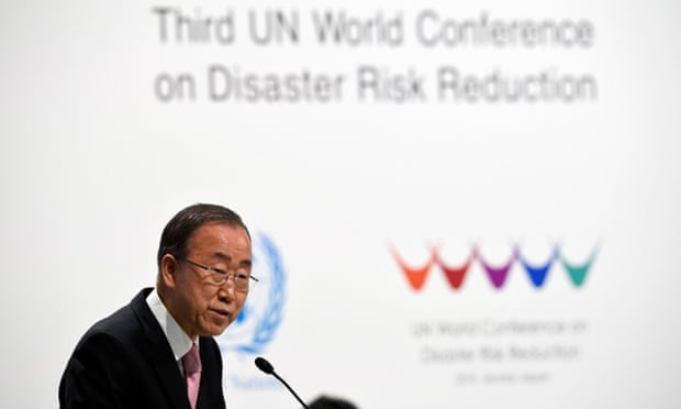
Governments at a UN conference in Japan set targets on Wednesday to substantially reduce deaths and economic losses from disasters, in the first of three major global agreements to advance development and tackle climate change this year.

After a marathon negotiating session that ended just before midnight, the talks adopted the Sendai Framework for Disaster Risk Reduction, a 15-year plan that will replace the existing 10-year blueprint.

“This new framework … opens a major new chapter in sustainable development, as it outlines clear targets and priorities for action which will lead to a substantial reduction of disaster risk and losses in lives, livelihoods and health,” said Margareta Wahlström, head of the UN Office for Disaster Risk Reduction (UNISDR).

Implementation “will be vital to the achievement of future agreements on sustainable development goals and climate later this year”, she added.

Experts described the inclusion in the agreement of seven targets to measure progress on protecting people and assets as a leap forward. But some were disappointed that earlier proposals for percentage goals were rejected.

Instead, the draft text includes targets to lower the global mortality rate from disasters between 2020 and 2030, compared with 2005 to 2015, and reduce the proportion of people affected. Another target is to reduce economic losses in relation to global GDP by 2030.

In the decade covered by the expiring Hyogo Framework for Action, more than 700,000 people lost their lives, and more than 1.5 billion people were affected by disasters. Total economic losses topped $1.3tn.

The new, non-binding agreement also includes targets to reduce damage to infrastructure and disruption to basic services, including health and education facilities, and to increase access to early warning systems and disaster risk information for the public.

Advertisement

But some disaster experts said a lack of a firm commitments in the agreement to ramp up international aid for risk reduction would undermine poorer countries’ efforts to make progress on the goals.

Only Japan put money on the table in Sendai, promising to provide $4bn in support over the next four years.

“Rich nations have pushed making financial commitments to reduce disaster risk to a separate round of financing negotiations later in the year,” said Farah Kabir, country director of ActionAid Bangladesh, referring to a conference in Ethiopia in July. Without larger financial commitments, “the results for vulnerable communities in poor countries will be catastrophic”, he added.

The devastation caused by cyclone Pam in the south Pacific island nation of Vanuatu at the start of the conference last week highlighted the need for greater efforts to protect those most at risk from extreme weather and other hazards. “Disasters, many of which are exacerbated by climate change and [are] increasing in frequency and intensity, significantly impede progress towards sustainable development,” the Sendai framework said.

“It is urgent and critical to anticipate, plan for and reduce disaster risk in order to more effectively protect persons, communities and countries … and thus strengthen their resilience,” it added.

Maggie Ibrahim, World Vision UK’s resilience manager, said the Sendai conference had spotlighted issues affecting disabled people, women and children in disasters. But the agreement would not equip them and other vulnerable people with the resources and tools to build skills so they can better prepare for disasters and avert crises, she said.

“This new plan in its current text and form has only become weaker with every subsequent draft,” she said.

source: theguardian.com

New FEMA regulations could impact disaster preparedness funds

KIMT News 3 – The Federal Emergency Management Agency (FEMA) is making changes that could impact disaster preparedness funds.

The agency says they will only approve these kinds of funds to states who have addressed the issue of climate change in their mitigation’s. That means state leaders like Gov. Terry Branstad, and Gov. Mark Dayton will have to recognize climate change as one of the driving factors in natural disasters, and in doing this, preparedness funds will then be available for their county emergency teams.

Steve O’Neil, the Emergency Management Coordinator for Cerro Gordo County, tells us while this won’t impact relief funds available after disaster strikes, it will make a drastic impact on how counties will prepare themselves for when disasters hit.

“The things that go into outdoor warning sirens and the different programs that we have that we can take into schools for preparedness all of that is pre-planning preparedness planning,” he explains. Without proper funds, projects and programs like this will be tougher to produce, and harder to come by.

Iowa is one of the states in the U.S. who do not have climate change language in their disaster mitigation plans. These plans are reevaluated every five years and O’Neil tells us that one, it’s time for the state to review the plan, Gov. Branstad will have to make the decision on whether or not to include climate change language.

These changes in funding will start next year.

Let’s be ready for any disaster

IN LESS THAN two months, the Atlantic hurricane season will begin. No one can accurately predict what it will offer; those living within its path can only expect the worst and hope for the best. The entire Caribbean chain which is exposed needs to be better prepared for any eventuality.
The issue of preparation also applies to the next big disaster which could be awaiting us in Barbados or our neighbours, whether floods, chemical or gas leaks, oil spills, earthquakes or even a tsunami. Are we ready and prepared for any such eventuality?

The reality is that we must stop looking to the United States, Canada, Britain and other rich nations to be our salvation in times of disaster. So while the US Southern Command, which has planned major cuts, has the means to respond to any major disaster in this region, the reality is that we must show a greater willingness to do more for ourselves, long before the times of peril. We need to appreciate that the Caribbean simply does not rank too high on Washington’s agenda.

That means member nations must give the Caribbean Disaster Emergency Management Agency (CDEMA) greater support, particularly financial. It is to be regretted that some countries have not been paying their dues.

At the local level, the Department of Emergency Management (DEM) and its equivalents across the region must also be well supported.

Just as important, we need volunteers in an active equivalent of the Neighbourhood Watch concept promoted by police, to be equipped to respond to the next big disaster.

The DEM and the Barbados Defence Force must implement the strategic goal of training community emergency response teams not only for every neighbourhood but all major employment centres.

We need to have certain safety fundamentals in place long before we think of asking or expecting external assistance. Perhaps before the start of the hurricane season an audit ought to be done to see how many houses are built or retrofitted to hurricane proof standards and how many householders know basic first-aid, rescue and/or firefighting techniques.

We also need to test the volunteers to determine what skills are most critical and what factors can stymie their effectiveness following a natural or man-made disaster and how best to apply these skills primarily within the community. It is a test to benefit every individual and corporate citizen.

Training will take money, regardless of who undertakes it. When the entire community is involved there is a great level of appreciation and it may be easier to find the funding even in difficult economic times. We need to become activists in disaster mitigation at the community level and promote the concept of self-help. We must not be seen as simply reaching out for alms.

See more at: http://www.nationnews.com

Asian disaster management to learn from Christchurch quakes

A group of South East Asian disaster management specialists will be in New Zealand later this month taking part in training hosted by the University of Canterbury’s Centre for Risk Resilience and Renewal (UCR3).

The group of future disaster management leaders come from eight of the ten ASEAN countries and will be undertaking a comprehensive two week programme focusing on strategic crisis leadership and an introduction to emergency exercise science to help better equip participants for crisis leadership roles in the future.

UCR3, headed by director Chris Hawker, is hosting three programmes over three years in partnership with the Ministry of Foreign Affairs and Trade who is funding the activity under the NZ Aid programme.

The UCR3 programme is a key component of the ASEAN Centre for Humanitarian Assistance (AHA Centre) six-month Executive Development Programme (ACE). The AHA Centre is an inter-governmental organisation, established by Brunei Darussalam, Cambodia, Indonesia, Lao PDR, Malaysia, Myanmar, the Philippines, Singapore, Thailand and Vietnam, to support the coordinated response to any disaster event which occurs across the ASEAN region.

The group will be meeting with a range of Government Agencies and organisations in Wellington and Christchurch and will be in New Zealand from March 22 to April 5.

The university’s UCR3 has organised a range of experiential activities and key speakers, including Professor Tim Davies, leader of the university’s Hazard and Disaster Masters Programme, Dr Christopher Gomez, who studied aspects of the 2011 Japan earthquake, Associate Professor Nilakant Venkataram who will discuss the issues of leadership’s highs and lows and Dr Erica Seville who will highlight issues of organisational resilience. Dr Gomez will be emphasising how important ethical aspects of disaster management are for ASEAN countries.

UCR3 is supported by Massey University’s Joint Centre for Disaster Research and Auckland University of Technology’s Emergency Management Programme, showcasing the best of New Zealand’s knowledge in the field of disaster management.

Hazard researchers to participate in vulnerability, resilience center

An elite group of urban planning researchers from Texas A&M University have been selected to collaborate with scientists from 11 universities in a nationwide initiative aimed at helping communities prepare for and recover from natural disasters.

This interdisciplinary team will collaborate through the newly established Community Resilience Center of Excellence to develop a set of user-friendly software tools to aid policy makers, planners or anyone with a need to reduce a community’s vulnerability and enhance its resilience to events like earthquakes, hurricanes, flooding and tornadoes.

The CRCE, based at Colorado State University, was established this year with a $20 million grant from the U.S. Department of Commerce’s National Institute of Standards and Technology.

“We’ve seen continually escalating trends in economic losses from natural hazards over the last several decades,” said Walter Gillis Peacock, director of Texas A&M’s Hazard Reduction and Recovery Center and head of the CRCE’s social science group, which also includes faculty from the university’s Center for Housing and Urban Development. “Natural catastrophes are escalating in number and magnitude and causing increasing damage because of rising sea levels and other factors related to climate change, and that is only part of the story.”

One of the primary reasons this is happening, said Peacock, is because of where and how we build our communities — for example, “we are expanding along coastlines, employing materials or methods that won’t withstand high hurricane winds or coastal flooding. In the process,” he added, “we often destroy natural buffers like mangroves, coastal wetlands and other natural resources that can help reduce disaster impacts.”

“We’re trying to determine how we can do better so we don’t continue to experience these kinds of massive losses,” he said.

CRCE experts are collaborating to develop a common language and metrics for measuring the economic, social and physical impacts of natural hazards. The models will provide a scientific basis for the center’s open-source software tools, which will be available online to help guide and assess planning and policy efforts. Such tools promise to improve decision-making by allowing communities to help justify and guide measures they take to decrease vulnerability and increase resilience.

With the software in place, policymakers, planners or community stakeholders will be able to determine the benefits of reducing potential hazard losses if their community, for example, adopts a particular building code, or chooses not to build in a high-risk area, said Peacock. “They will be able to make quantitative comparisons of different strategies,” he said.

To realize this scenario, CRCE partners first have to lay the groundwork. Texas A&M researchers have a 25-year head start in collecting vulnerability and resiliency findings and data that can inform the project.

Recent research initiatives include post hurricane disaster studies in Galveston, investigating increased vulnerability of lower-income populations in disaster areas, examining the critical role that small businesses play in disaster recovery, measuring disaster resilience indicators for coastal communities, and many more.

Texas A&M researchers engaged in the CRCE initiative, all members of the Department of Landscape Architecture and Urban Planning faculty, include Shannon Van Zandt, associate professor and director of the Center for Housing and Urban Development, and Yu Xiao, associate professor.

Co-directing the CRCE effort at Colorado State University are SCU faculty John W. van de Lindt, the George T. Abell Distinguished Professor of Infrastructure who serves as principal investigator, and Bruce Ellingwood, professor of civil and environmental engineering.

The center’s multi-disciplinary team also includes experts in engineering, economics, data and computing, and social sciences from the University of Oklahoma, Rice University, the University of Washington, the University of South Alabama, the California Polytechnic University in Pomona, Texas A&M University-Kingsville, University of Illinois at Urbana-Champaign, and Oregon State University.